views
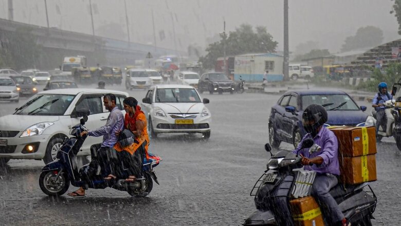
Normal life in Gurugram was affected after spells of rain on Tuesday caused waterlogging in several areas of Haryana’s hub of multinational companies.
Traffic snarls were witnessed in several parts with commuters wading through waterlogged roads.
#WATCH | Commuters face trouble as a service road gets waterlogged near Subhash Chowk following rainfall in Haryana’s Gurugram pic.twitter.com/Em5gRSSNzO— ANI (@ANI) July 4, 2023
Skymet Weather Official Mahesh Palawat predicted intense rain in Gurugram and said its intensity may increase by tomorrow and the entire Delhi might get good rain.
Meanwhile, in Gurugram’s neighbouring Delhi, four flights were diverted from the airport in the afternoon on Tuesday due to bad weather.
The official said three flights were diverted to Amritsar and one flight to Lucknow. All were domestic flights.
Light rainfall or thundershower has been predicted for Delhi on Tuesday.
The India Meteorological Department (IMD) predicted heavy rainfall over coastal and south interior Karnataka, Kerala and Maharashtra during July 4-6; Goa and Maharashtra during July 4-7; Sub-Himalaya West Bengal, Sikkim, Assam and Meghalaya on July 4; Tamil Nadu, Puducherry and Karaikal on July 4-5; Coastal Andhra Pradesh and Yanam, Telangana on July 4 and Gujarat state on July 7-8.
The IMD said western end of the Monsoon trough at mean sea level lies near its normal position while its eastern end lies to the south of its normal position.
A cyclonic circulation lies over central parts of Uttar Pradesh in lower tropospheric levels while the off-shore trough at mean sea level runs from south Gujarat coast to Kerala coast.
The weather forecasting agency also said a cyclonic circulation lies over south Gujarat and its neighbourhood in middle tropospheric levels and also over Westcentral Bay of Bengal and adjoining north Andhra Pradesh coast in
lower and middle tropospheric levels.
Monsoon Covers Entire Country Six Days Early: IMD
Earlier on Sunday, the IMD said the southwest monsoon has covered the entire country six days before the normal date, as it advanced in the remaining parts of Rajasthan, Punjab and Haryana.
The weather office said the monsoon covered the entire country on Sunday, against the normal date of July 8. As many as 16 states and Union territories received deficient rainfall in June, with Bihar and Kerala reporting large deficits at 69 per cent and 60 per cent below normal, respectively.
Some other states such as Uttar Pradesh, Maharashtra, Karnataka, Jharkhand, Andhra Pradesh and Telangana also received less rainfall than what is normal for June, the first month of the southwest monsoon season. “The monthly rainfall averaged over the country as a whole during July 2023 is most likely to be normal (94 to 106 per cent of LPA) and most probably within the positive side of the normal,” IMD Director General Mrutyunjay Mohapatra had said on Friday.
The long period average (LPA) of rainfall over the country during July based on the data of 1971-2020 is about 280.4 mm. The phenomenon of warming of the equatorial Pacific Ocean, called the El Nino conditions, are expected to develop in July. El Nino is known to suppress monsoon rainfall.
(With PTI inputs)


Comments
0 comment