
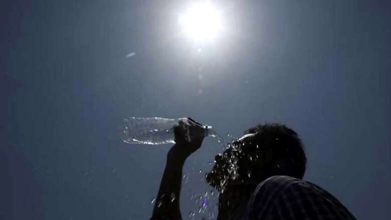
At a time when orange alert has been issued in Mumbai with a forecast of "intermittent heavy to very heavy rainfall", and most of the country is reeling under-above normal temperatures, the World Meteorological Organisation (WMO) has warned that next three months will be warmer.
The WMO said that the change in mercury will be witnessed primarily in the tropical latitudes of Asia, including India, as the El Niño, a global ocean phenomenon, has turned neutral. El Niño is associated with warm ocean water over the central and eastern Pacific Ocean. It has a warming influence on global temperatures and has been linked to hazards such as torrential rain, floods and drought. Cycles of malaria have also been linked to El Nino and in India, it heavily influences the southwest monsoon and has been linked to less than normal rainfall. With it turning neutral in July, the southwest monsoon has gained strength.
“July 2019 was the hottest month on record, with heatwaves and other extreme weather conditions, even without a strong El Niño event,” said Maxx Dilley, director of WMO Climate Adaptation and Prediction Branch. “The signal from human-induced climate change has now become more powerful than that from a major natural force of nature,” he said.
Slightly above average sea surface temperatures are likely to remain for the rest of 2019 and into early 2020, although remaining within ENSO-neutral levels. The chance of neutral conditions during September-November 2019 is estimated at about 60 per cent, while chances for El Niño and La Niña are about 30 per cent and 10 per cent, respectively. Although neutral conditions are most likely through the December-February 2019-20 season, the chance for a return to El Niño rises slightly to 35 per cent, according to the update, which is based on forecast models and expert opinion from around the globe.
The southwest monsoon, meanwhile, has picked up pace in its last leg in Mumbai and after no rainfall was recorded for the past two weeks, the IMD has issued an "orange alert" with Mumbai and Palghar likely to receive “heavy rain at isolated places” on Wednesday. The IMD weather summary and forecast bulletin on Wednesday predicted "fairly widespread to widespread rainfall with isolated heavy to very heavy falls" at Chhattisgarh, Odisha, Coastal Andhra Pradesh, Telangana, Vidarbha during the next 48-hours and over Madhya Pradesh, West Coast and Gujarat.
An official told News18, "Central India has received 15 per cent more than long period average rainfall in the last week that ended on August 28. Western parts of MP have seen more than double rainfall, and rainfall in Kerala has been almost double the average. Even parts of central and west coastal region, eastern Rajasthan and Odisha have seen significant rainfall. But the rest of India has seen below normal rainfall. This I sparticularly pronounced in the east and northeast of India."
The maximum temperatures across India have been higher than usual. They have been "markedly above normal" (5.1 degrees or more) at many places over Arunachal Pradesh, and "appreciably over normal" (3.1 degrees to 5.1 degrees) at different areas of Assam, Meghalaya, Uttarakhand, Nagaland, Manipur, Mizoram and Tripura.
Temperatures in Delhi have also been on the rise in the past week, with light showers. "The maximum and minimum temperatures will be around 35 and 26 degrees Celsius," the official added.


Comments
0 comment