
The season’s first cyclonic storm is brewing in the Bay of Bengal and is likely to intensify in the next three days. The IMD has issued a pre-cyclone watch for West Bengal as the storm is likely to reach close to the Bangladesh and adjoining West Bengal coast on the evening of May 26.
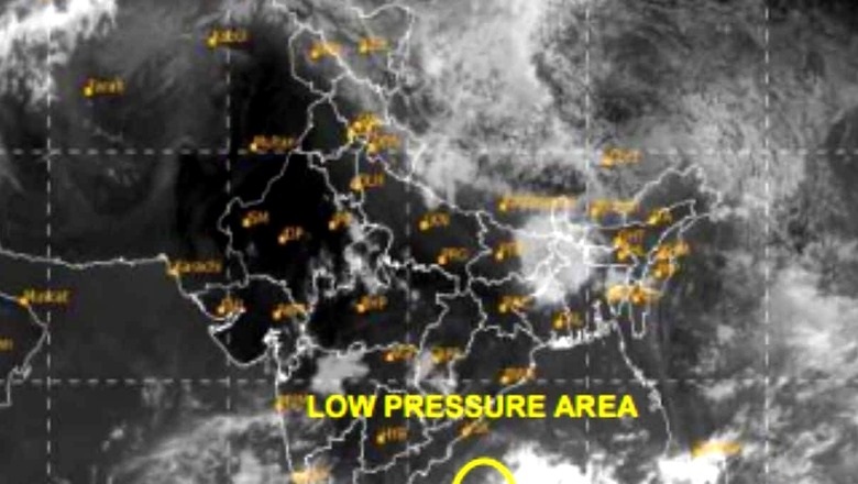
The low pressure area first formed over southwest and adjoining west-central Bay of Bengal on May 22, and moved north-eastwards. It became more well-marked on Thursday morning. The weather forecast suggests it will move north-eastwards towards the West Bengal coast and intensify into a depression over central parts of the Bay of Bengal by Friday morning (May 24).
“Thereafter, it is very likely to continue to move north-eastwards, intensifying further into a cyclonic storm over east-central Bay of Bengal by May 25 morning. Subsequently, it would move nearly northwards and reach near Bangladesh and adjoining West Bengal coasts by May 26 evening as a severe cyclonic storm,” the IMD said in its forecast.
Heavy rain along coastal districts
A severe cyclonic storm can have sustained wind speed of nearly 89 to 117 kmph, which can go up to 118 to 167 kmph if it turns into a very severe cyclonic storm. They cause heavy rains, strong winds and also high seas, causing devastation in coastal areas at the time of landfall that may lead to loss of life and property.
The North 24 Parganas and South 24 Parganas districts as well as East Medinipur in West Bengal could see light to moderate rainfall with heavy rainfall over some areas on May 25 and 26. Heavy rains are also likely to lash Odisha’s Balasore district from May 25 to 27. Mizoram, Tripura and south Manipur can also expect light to moderate rainfall over the weekend.
Squally winds reaching 40-50 kmph gusting to 60 kmph are likely along & off Bangladesh, West Bengal and adjoining North Odisha coasts from May 25 evening.
The IMD has already issued warnings for fishermen, asking them not to venture into the south Bay of Bengal till May 24 and North Bay of Bengal from May 24 to May 27. Those who are already out have been asked to return to the coast.
South 24 Parganas, North 24 Parganas, Medinipur and Kolkata in West Bengal, and Balasore in Odisha are among the most cyclone-vulnerable districts of India.
Monsoon at doorstep…
About five to six tropical cyclones generally form in the North Indian Ocean annually, and they predominantly occur during the pre-monsoon season (March-April-May) and the post-monsoon season (October-November-December). Their occurrence around the onset of monsoon can sometimes strengthen or weaken the rainy season depending on the conditions.
According to the latest forecast, the southwest monsoon is advancing over the Bay of Bengal and conditions look favourable for its progress over some more parts of South Bay of Bengal, remaining parts of Andaman and Nicobar Islands, and some parts of East-Central Bay of Bengal during the next two days.
With large parts of India reeling from intense heatwaves, the arrival of the southwest monsoon is eagerly awaited. As predicted by the IMD, the monsoon could make its onset over the Kerala coast around May 31 (forecast error +/-4 days), and usually covers the country by July 8.
Explore in-depth coverage of Lok Sabha Election 2024 Schedule, Voter Turnout, Upcoming Phase And Much More At News18 Website


Comments
0 comment