views
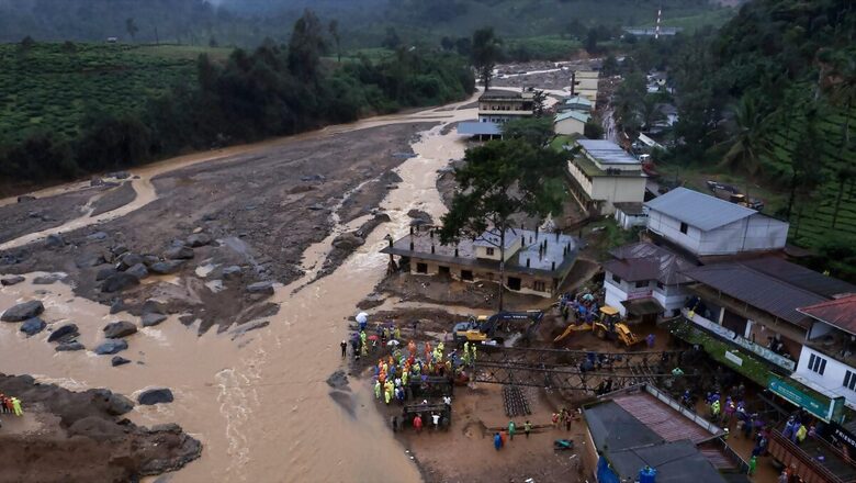
Two days after the massive landslides that hit the hilly town of Wayanad in Kerala which claimed over 250 lives, the Indian Space Research Organisation (ISRO) released satellite images of the extensive damage caused in the region.
The massive landslides which struck Wayanad on Tuesday claimed the lives of at least 256 people and left 206 missing. Indian Army, NDRF along with local emergency response departments have undertaken a massive search and rescue operation to trace people feared to be trapped in the tragedy.
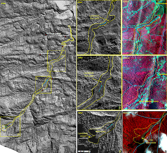
The National Remote Sensing Center (NRSC) in Hyderabad flew ISRO’s advanced Cartosat-3 optical satellite and the RISAT satellite to capture the extent of the devastation brought by the landslides in Wayanad.
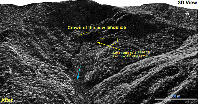
Triggered by heavy rainfall, the landslide originated at an altitude of 1,550 meters. According to the NRSC report, the landslide was exacerbated by a major debris flow initiated by torrential rains in and around Chooralmala town. The area extent of the landslide is 86,000 square meters.
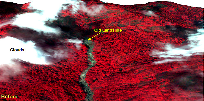
The satellite images depict the before and aftermath of the landslide where the debris flow widened the river’s course, resulting in significant damage to houses and infrastructure along the banks.

A 3D rendition of the landslide crown illustrates that a large section of the hill slope has been affected.

The satellite data also indicates the presence of an old landslide at the same location, highlighting the area’s vulnerability to such disasters.

The Rescue teams resumed the rescue efforts on Thursday at several places in Wayanad. Kerala Minister K Rajan said that over 1600 forces are involved in the rescue operations. says, “This day is very important, more than 1600 forces are involved in the rescue operations. Social workers are also involved…CM arrived at Kalpetta around 9:30 am and at 10:30 am there will be a meeting with officials…he will visit this spot after that,” he said.


Comments
0 comment