views
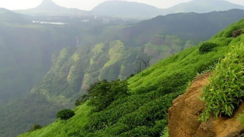
The southern limit of Aryavarta (or more broadly, the Uttarapatha) is the Vindhya mountain range. The Vindhya (literally meaning, “to obstruct”), like its more imposing and majestic brother-rival Himalaya, has a paramount salience in the annals of Hindu sacred literature. Vindhya is also known as Vindhyachala, where achala means mountain. The Mahabharata calls it the Vindhyaparvata. The Kaushitaki Upanishad calls it the Dakshinaparvata. Ptolemy, the Greek geographer, called it Vindius or Ouindion.
In our sacred annals, the Vindhya, like the Himalayas, is also a stern but highly accommodative mountainous monarch who places his lofty pedestal obediently at the feet of Devatas and Rishis. If Himalaya gave his daughter Parvati—daughter of Parvata or mountain—in marriage to Shiva, Vindhya humbly agreed to dwarf his growth at the command of the Rishi Agastya.
The “modern” Hindu mind unthinkingly discards an ocean of values embedded in such Pauranic stories based on undefined notions of “realism.” One such value—on the “practical” and “realistic” plane—is the fact that for more than a millennium, these tales constituted an entire education that taught the nuances of our geography down to the last unlettered man without the boredom induced by modern geography lessons taught in classrooms. And our people gladly learnt it without formal education. The medium was the story. The language was sanctity. Indeed, the reverence ascribed to our geography was what preserved their beauty and prevented their destruction and transmitted our literature and culture throughout this vast country.
Unfortunately, Western scholars of Indology have grasped this fundamental point, which we have forgotten. There’s a reason that Harvard academic Diana Eck titled her book as India: A Sacred Geography, the emphasis is on the word “sacred”. Our cultural amnesia is a big factor for the casual pillage and despoilation of our rivers and mountains and forests that have occurred more rapidly after independence.
While the Great Plain of North India is continuously hydrated by a complex web of rivers, the expansive region to the south of the Vindhya is walled by a chain of intimidating mountain ranges and harsh passes and treacherous ravines and arid plateaus and deceptive rivers.
This broad layout of Dakshinapatha (or simply, Dakshina), the original word for “Deccan,” has a continuously recorded history dating back to the third century BCE. To cite a random example, the hoard of Mauryan inscriptions and Ashoka’s edicts especially in and around the Brahmagiri region near Chitradurga, and near Shravanabelagola reveal an unbroken civilisational and Dharmic continuity. The long-term dangers to the civilisational integrity of Bharatavarsha inherent in the cynical and fraudulent narrative of an alleged north vs south divide will become evident when we study these primary sources.
Muslim chronicles pronounce Dakshinapatha as Dakhin and Dakkhan. The word Deccan is the anglicised form of this Islamic linguistic corruption.
Dakshinapatha is further cut up into three major slices:
- The Northern Deccan Plateau comprising the Maharashtra Plateau, located south of the Satpura Range.
- The Eastern Plateau that includes Telangana and Rayalaseema running parallel to the East Coast.
- The Southern Plateau comprising the northwestern regions of Karnataka, sandwiched between the Northern and the Eastern Plateaus.
And finally, we notice the elongated natural fortress of the Western Ghats lying parallel to the Arabian Sea. It safeguards the entire plateaued region of Maharashtra and Karnataka while the Eastern Ghats running parallel to the East Coast affords a similar protection to the Telangana Plateau.
This complex and mind-bending geography of Dakshinapatha is further complicated when we survey its zigzagged riverine networks. All three major rivers, Godavari, Krishna and Kaveri originate as streams in the Western Ghats. As they stretch and sprawl all over, they collect rain from the bordering hills before branching out into scores of diverse-sized tributaries, finally emptying into the Bay of Bengal.
From one perspective, the civilisational history of Dakshinapatha is also the history of its riverine cities. Likewise, the mercantile routes that led to and continued in South India from time immemorial followed the course of its rivers.
From a historical standpoint, Jadunath Sarkar again paints a captivating panorama of Dakshinapatha: “Thus Nature has cut the Deccan up into many small isolated compartments, each with poor resources and difficulty of communication with its neighbours… long parallel mountain chains… run west to east, cutting the country up into isolated districts…”
Despite this sort of nature-imposed obstacles, Dakshinapatha was the birthplace of several glorious pan-Indian Hindu Empires. Beginning with the early medieval age, Karnataka alone supplied three pan-Indian empires—Chalukya, Rashtrakuta and Kalyana Chalukya—while Tamil Nadu birthed the grand Chola Empire which stretched its influence all the way up to South-East Asia. The combined timeline of all Hindu Empires that arose and ruled from Dakshinapatha is roughly around 1,500 years.
This overall picture of Bharatavarsha’s geography comes alive in a brilliant and often brutal fashion when we regard it as a great military theatre placed on the canvas of time. In a limited sense, in some of its particulars, it has all the dimensions of a cosmic play that Bharatavarsha was both fortunate and ill-fated to participate in.
We will explore this theme in the next episode of this series.
To be continued
The author is the founder and chief editor, The Dharma Dispatch. Views expressed in the above piece are personal and solely that of the author. They do not necessarily reflect News18’s views.


Comments
0 comment