
After Relief, Heatwave May Return in Northwest, Central India; Cyclone Likely Over Andaman | Details
A fresh spell of heatwave is likely to begin over northwest India from Saturday and over central India from Sunday, the India Meteorological Department (IMD) said.
Heatwave conditions are predicted over Rajasthan on May 7 to May 9, and over south Haryana, Delhi, southwest Uttar Pradesh, Madhya Pradesh and Vidarbha region of Maharashtra on May 8 and May 9, it said.
Light rains and thundery development, however, cooled down large parts of Delhi, especially central Delhi, on Friday afternoon even as the day ended with 38.4 degrees Celsius maximum temperature that is set to rise from Saturday.
Sizzling April
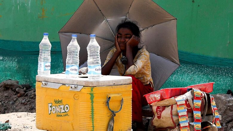
With scanty rains owing to feeble western disturbances, northwest and central India experienced the hottest April in 122 years with average maximum temperature touching 35.9 degrees Celsius and 37.78 degrees Celsius, respectively. Several places in the country had logged their all-time high temperatures for April as the mercury leaped to 46-47 degrees Celsius under the impact of the torrid heatwave at month-end.
Amid the intense heatwave, India’s peak power demand had reached an all-time high of 207.11 GW on Friday. India saw its warmest March this year since the IMD began keeping records 122 years ago, amid a 71 per cent rain deficit.
Understanding Heatwave
A heatwave is declared when the maximum temperature is over 40 degrees Celsius and at least 4.5 notches above normal. A severe heatwave is declared if the departure from normal temperature is more than 6.4 notches, according to the IMD. Based on absolute recorded temperatures, a heatwave is declared when an area logs a maximum temperature of 45 degrees Celsius. A severe heatwave is declared if the maximum temperature crosses the 47-degree Celsius mark.
Delhi Weather
Light rains and thundery development cooled down large parts of Delhi, especially central Delhi, on Friday afternoon even as the day ended with 38.4 degrees Celsius maximum temperature that is set to rise from Saturday.
Preceded by strong winds and thundery conditions, the rainfall, however, lasted barely for less than 15 minutes.
Across Delhi NCR, maximum temperature remained below 39 degrees Celsius as Safdarjung and Ridge stations recorded trace rainfall and Lodhi Road recorded 1 mm rainfall between 11.30 to 2.30 p.m., the India Meteorological Department (IMD) said.
Before that, the wind speed was 18 kmph gusting to 30 during 12 noon to 1 p.m. at Palam.
Delhi NCR – along with northwest Indian plains – have witnessed three heatwaves during March and April and after this week’s brief break from torturing heat, the temperatures are set to rise again from Saturday.
IMD has predicted partly cloudy sky with possibility of thundery development. The maximum and minimum temperatures are likely to be 41 and 25 degrees Celsius respectively.
Low Pressure Area over South Andaman Sea, Likely to intensify into cyclonic storm by Sunday
The Low Pressure Area (LPA), formed over South Andaman Sea, is likely to intensify into a depression by Saturday evening and further into a cyclonic storm by Sunday evening, the IMD said on Friday.
The India Meteorological Department (IMD) had earlier in the morning said the LPA was very likely to move northwards and intensify into a depression during the next 48 hours.
The PA formed over South Andaman Sea and adjoining southeast Bay of Bengal after intensifying into a cyclonic storm is very likely to continue to move northwestwards and reach west-central Bay of Bengal off north Andhra-Odisha coasts by May 10.
Under its influence, scattered to fairly widespread light/moderate rainfall is very likely over Arunachal Pradesh, Assam, Meghalaya, Nagaland, Manipur, Mizoram, and Tripura during next five days with isolated thunderstorm/lightning over Assam and Meghalaya till May 8.
The IMD also predicted that isolated heavy rainfall is very likely over Arunachal Pradesh, Nagaland, Manipur, Mizoram, and Tripura on May 10 and over Assam, and Meghalaya on May 9 and 10.
It has also forecast squally wind speed reaching 40-50 kmph gusting to 60 kmph very likely to prevail over South Andaman Sea and adjoining southeast Bay of Bengal and Andaman and Nicobar Islands for next three days and warned fishermen not to venture into the Andaman Sea and southeast Bay of Bengal that are likely to be rough to very rough.
Rainfall in Telangana
“The Southern state of Telangana is likely to have light to moderate rainfall during next three to four days with thunderstorms and lightning. Wind speed at 30-40 km/h is expected in some districts. Thereafter temperature is likely to increase by 2-3°C,” said Naga Ratna, Director, Meteorological Centre, Hyderabad
Heavy rains, accompanied by gale and thunderstorms, lashed several parts of Telangana on Wednesday. The IMD had issued a yellow alert for Kothagudem, Khammam, Nalgonda, Suryapet, Mahabubabad and Nagarkurnool districts for the next four days indicating light to moderate rain or thundershowers to occur in a few places over Telangana.
“Thunderstorms accompanied with lightning and gusty winds (30-40 kmph) likely to occur at isolated places in few districts of Telangana,” the bulletin said.
Read all the Latest India News here


Comments
0 comment