views
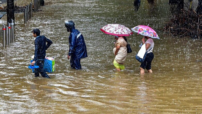
The southwest monsoon may have broken over the Kerala coast two days behind schedule but it has progressed rapidly to cover two-thirds of the country, triggering intense rainfall in Maharashtra, West Bengal, Odisha and Karnataka. Several northern states have also been experiencing cloudy sky and moderate downpour.
According to weather predictions, widespread rainfall with isolated heavy showers is expected along the west coast due to strengthening of westerly winds and off-shore trough along west coast towards end of month. Rainfall is said to be “near normal” in the remaining parts of the country outside northeastern states and extreme southern parts of southern Peninsular India.
The India Meteorological Department (IMD) has said in its two-week forecast that monsoon progress is likely to pick up between June 27 and June 30 and advance to most parts of northwest India outside west Rajasthan.
Other Phenomena Behind Rainfall Across India
In the eastern region, a cyclonic circulation over Gangetic West Bengal and neighbouring areas is causing widespread rainfall. Heavy to very heavy rain is expected in Bihar, Jharkhand, West Bengal, Sikkim and north Odisha during the next two-three days.
A cyclonic circulation is also lying over east Uttar Pradesh and its neighbourhood, raising possibility of heavy to very heavy downpour over east Uttar Pradesh during the next two-three days. Uttarakhand will also see heavy to very heavy rains due to a western disturbance that is running from north Jammu & Kashmir to northeast Arabian Sea.
An offshore trough (line of low pressure), running from south Gujarat coast to north Kerala coast, will cause rains over Konkan, Goa, Madhya Maharashtra Karnataka, Kerala and Mahe.
Moderate Rainfall in Maharashtra
Mumbai on Saturday is expected to witness moderate rainfall, according to the local weather forecast. Regional Meteorological Centre, IMD predicted that Mumbai will receive moderated rainfall in the city and suburbs with heavy showers at isolated places.
IMD has marked Mumbai and Thane ‘green’ for Saturday. Mumbai and adjoining areas witnessed moderate to intense spells of rain on Friday. The districts that were affected are Palghar, Thane, Mumbai, Raigad, Ratnagiri and Sindhudurg.
According to IMD, Bandra received 59.5 mm of rainfall till 12 am last night, while Dahisar received 137.5 mm of downpour, Juhu airport 63.5 mm, Ram mandir 68.0 mm and Tata power in Chembur 59.0 mm. on Friday.
IMD said that four districts of Maharashtra–Mumbai, Thane, Palghar and Raigad would witness heavy rainfall on Saturday.
More Rain over Three Days in West Bengal
Heavy rainfall since Wednesday in the state capital and most parts of West Bengal led to waterlogging in several areas in Kolkata and several districts across the state. The Met department has predicted more rain over the next three days in all the districts.
“Due to presence of cyclonic circulation over the Gangetic West Bengal and the neighbouring region, and strong moisture incursion from the Bay of Bengal, widespread rainfall activity is likely to continue over the districts of West Bengal till Saturday,” the Met Department was quoted as saying by Indian Express.
The Met department has issued an orange warning for Murshidabad, Birbhum, Paschim Bardhaman, Bankura and Purulia districts where heavy to very heavy rainfall (70-200 mm) is likely to occur at one or two places.
IMD Issues Red Alert in Karnataka
The IMD on Friday issued red alerts for heavy to very heavy rainfall in three districts in Karnataka for Friday and Saturday. IMD has also issued an orange alert for three other districts for the same period.
“Red alert for heavy to very heavy rainfall issued in Dakshin Kannada, Udupi and Uttara Kannada districts for today and tomorrow. Orange alert issued in Kodagu, Hassan, Chikkamagaluru and Shivamogga districts for the same period,” news agency ANI on Friday quoted IMD Karnataka as saying.
Heavy Rainfall Likely in Odisha
Several parts of north and south Odisha experienced light to moderate rainfall in the past 24 hours. The IMD on Thursday had informed that the Southwest Monsoon is active over Odisha.
As per the forecast for the next 24 hours, heavy rainfall is likely to occur at one or two places over the districts of Sundargarh, Jharsuguda, Bargarh, Sambalpur, Deogarh, Angul, Keonjhar, Mayurbhanj, Balasore, Bhadrak, Kendrapara Jajpur and Dhenkanal , informed the IMD.
Delhi Witnesses Pre-monsoon Rainfall
A short spell of rain lashed several parts of the national capital on Thursday providing respite from the hot weather to the residents. The city recorded a maximum temperature of 35 degrees Celsius, four notches below normal, while the minimum temperature settled at 26.2 degrees Celsius, two notches below season’s average, according to the Indian Meteorological Department.
The relative humidity recorded was 51 per cent. The weatherman has forecast generally cloudy sky with light rain or drizzle in Delhi on Friday. Delhi’s air quality was in the moderate category on Thursday. Data from the Central Pollution Control Board showed that the hourly air quality index (AQI) at 7.05 pm stood at 108.
Read all the Latest News, Breaking News and Coronavirus News here.


Comments
0 comment